
The South Mianeh Magnetometry and Gravimetry Project successfully completed ahead of schedule, covering 5,800 sq km in two provinces. Overcoming challenges like extreme weather and permit issues, the project utilized advanced technology and a skilled workforce to achieve its objectives.
South Mianeh Magnetometry and Gravimetry Project
CATEGORIES :
- Location Mianeh, East Azerbaijan
- Start Date February 2022
- End Date September 2022
According to Contract No. 99112, the design of geometries and magnetometers for South Mianeh was entrusted to Dana Energy by the NIOC Exploration Directorate. The project encompassed an area of approximately 5,800 square kilometers (around 170 km x 35 km) and involved the establishment of 5,800 gravity and magnetometer stations at one-kilometer intervals, along with 200 Nettleton stations. The entire contract was scheduled to be completed within a duration of 9 months.
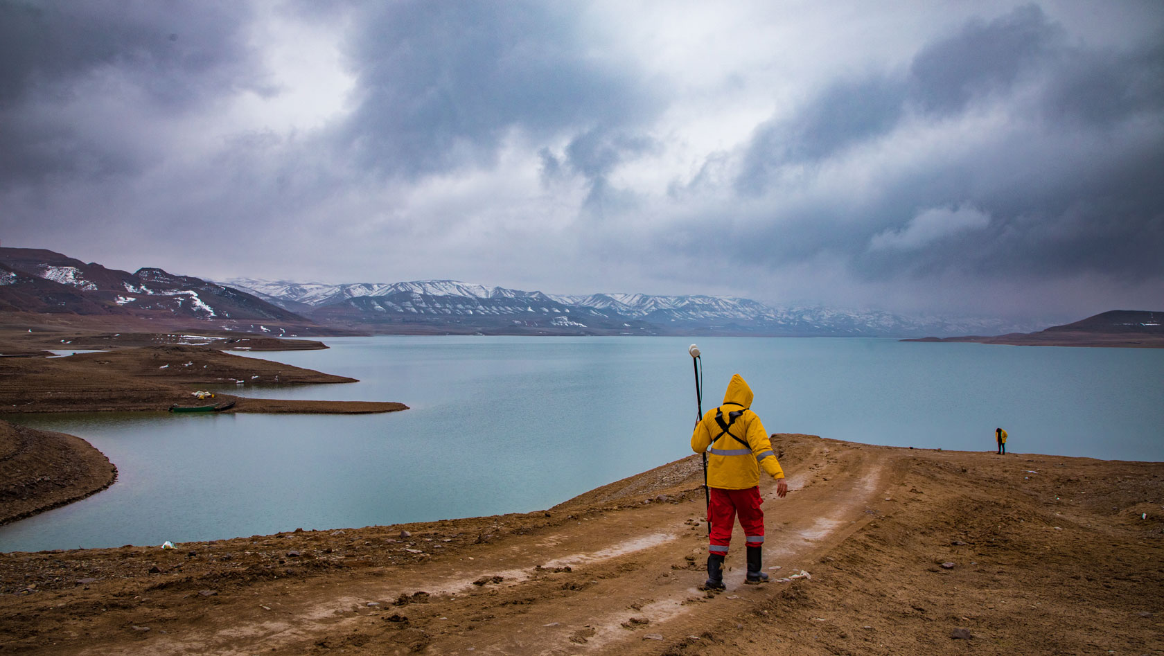
Located in the two provinces of Zanjan and East Azarbaijan, between the city of Zanjan and the city of Hashtroud. In the middle area of the project, topographical conditions with lower elevations, consisting of plains, flat and fertile lands, or sloping hills could be observed. Moving towards the northern and southern parts of the project, semi-mountainous and mountainous areas with steeper slopes were visible. The highest altitude in the region was approximately 2,250 meters above sea level. The city located in the middle, which had the most suitable conditions for accommodating people and providing equipment, was chosen as the campsite.
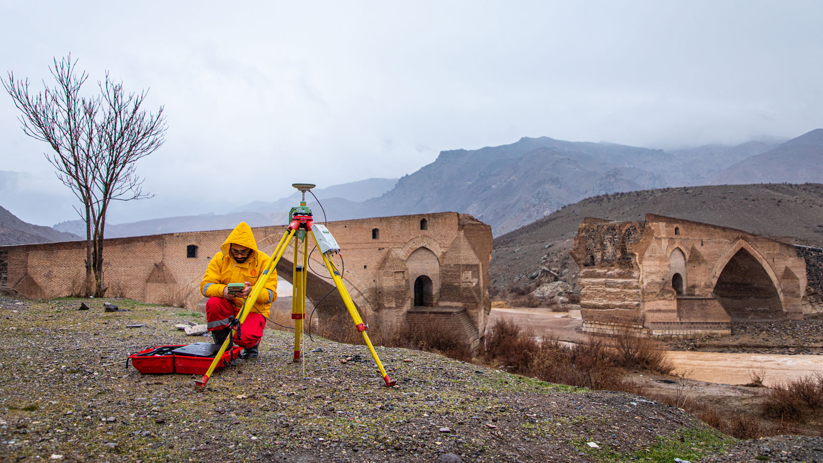
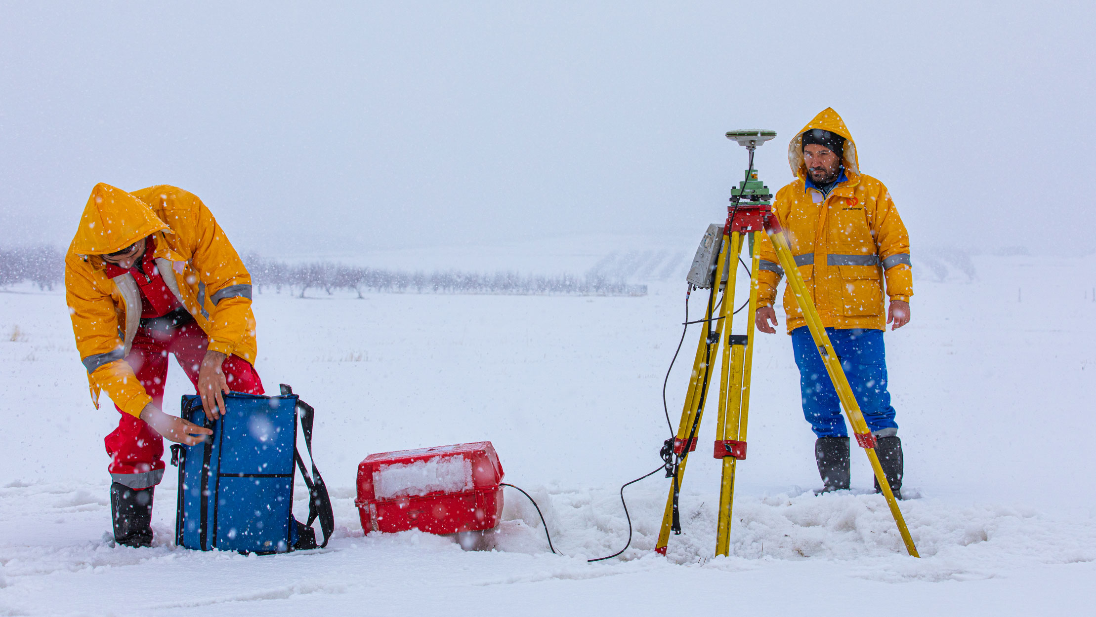
Considering the commencement of satellite geodetic network operations during winter and the unique characteristics of geodetic and magnetometry projects, a satellite geodetic network consisting of 64 mapping stations was designed, implemented, and successfully completed within a span of 35 days.
According to the contract, the project started in February 2022, and the implementation of the objectives was successfully concluded within a span of 130 days in May 2022. It is noteworthy that this project was completed more than two months ahead of the contractual deadline, with a margin of almost 70 days.
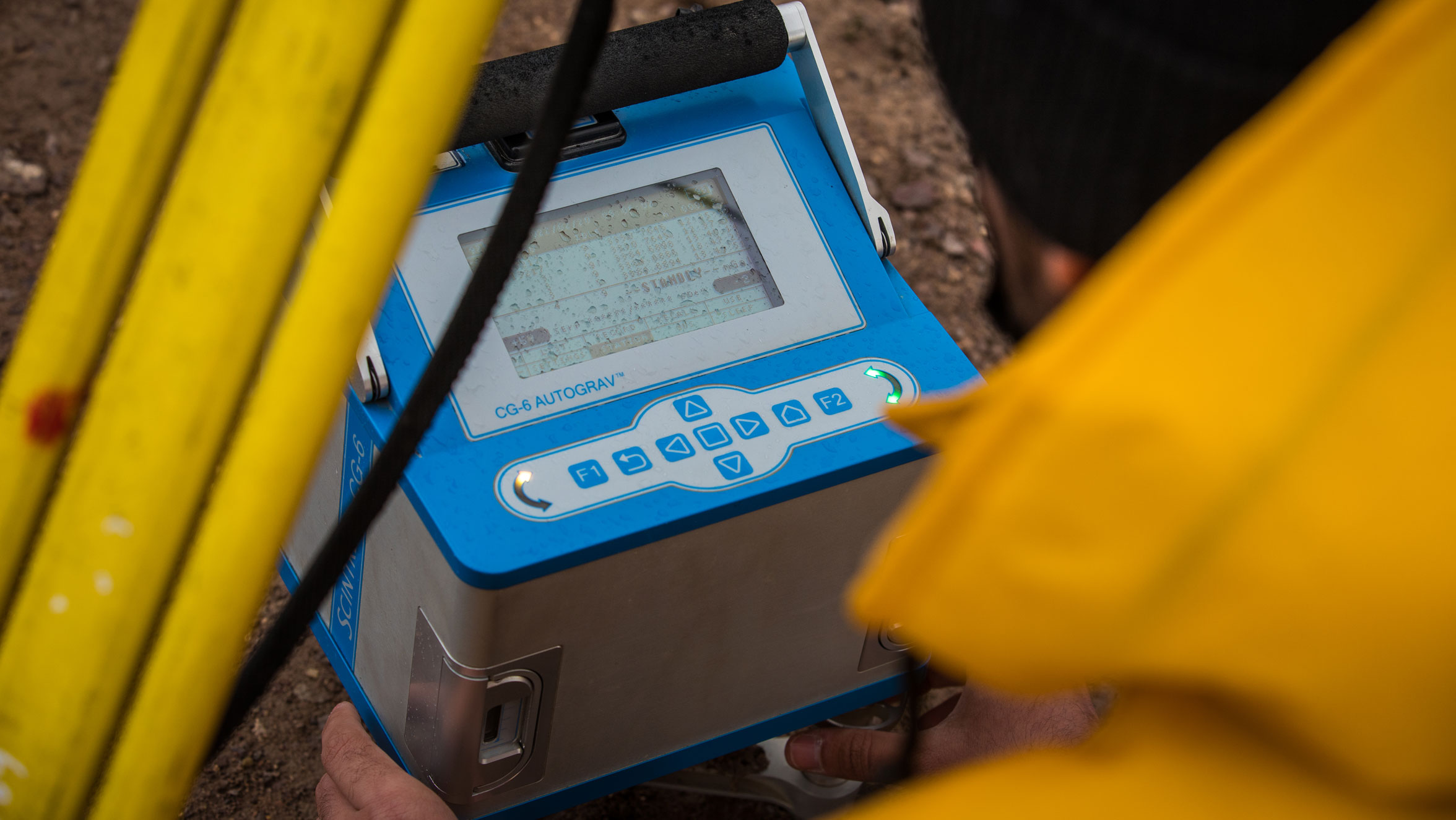
In this project, 9 dual-frequency Leica mapping satellite receivers, 6 CG-6 gravimetric devices and 7 GSM-19T magnetometer devices were used for 6 operational teams with the cooperation of a total of 52 people, including experts, operators, laborers and service personnel.
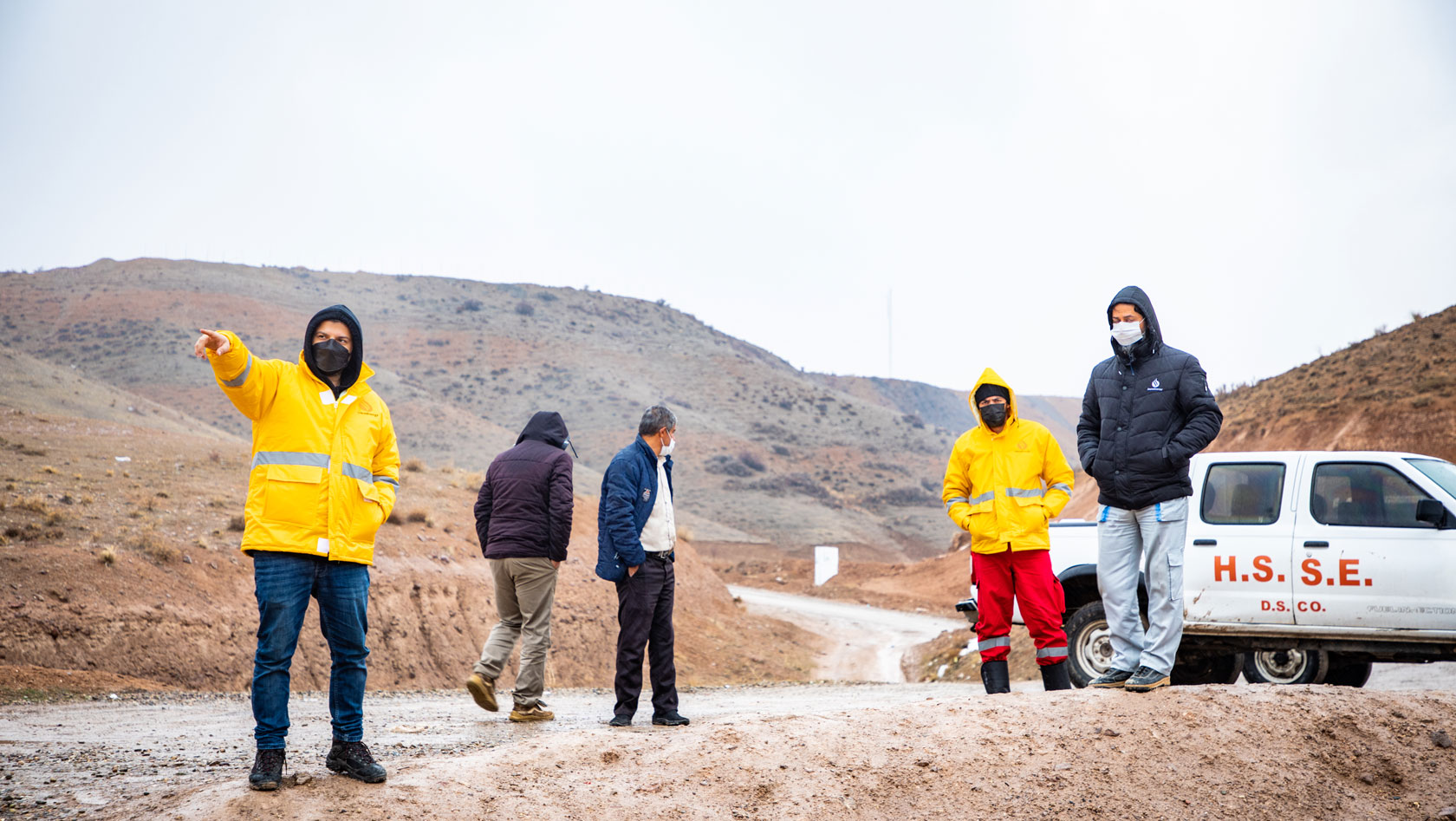
During the implementation of the operation, the operational teams encountered various problems and challenges, some of which are outlined below:
- Difficulties in acquiring suitable operational vehicles and attracting a labor force.
- Lack of experienced operators and the need for operational training.
- Traffic issues and risks associated with road and railway conditions throughout the project.
- Permit complications for accessing military areas, airports, dams, etc.
- Challenges and coordination required for entering protected areas such as Kaghazkonan Charuymaq, and Anguran.
- Issues arising from frequent snowfall, frost, fog, and cold weather.
- Permit problems and a lack of understanding among local residents regarding the explorative nature of the project, leading to operations being suspended and teams and equipment being seized by police forces.
Defining an effective motivational system for operational personnel played a significant role in increasing the productivity.
Alireza Abedloo, Project Manager
Despite the cold and snowy weather conditions in the region, the ongoing spread of the Corona virus, and the challenging topographical conditions in certain areas, the project was successfully completed without any incidents. This achievement was made possible thanks to the observance of safety and health principles by our operational colleagues and personnel, as well as the continual support of management.
Tags :